Latest News
April 12 Training Set in Use of Upper Delaware River GIS Mapping Tool
NARROWSBURG – The Upper Delaware Council (UDC) and the National Park Service (NPS) Upper Delaware Scenic and Recreational River will offer virtual training on April 12 in the use of a new, publicly available Upper Delaware Corridor mapping application.
The 6:30 p.m. Zoom workshop will feature Dr. Claire Jantz, director of the Center for Land Use and Sustainability (CLUS) at Shippensburg University, providing an instructional overview and answering questions about the tool’s capabilities.
This free public session is particularly appropriate for code enforcement officers, planning and zoning board members, county GIS technicians, and land use consultants in the bi-state river valley region.
To register and receive the Zoom link for the April 12 training, visit: https://www.eventbrite.com/e/upper-delaware-gis-tool-training-tickets-146968489709. Members of local planning and zoning boards will receive 1 training credit hour for attending the session. UDC will send certificates following completion of the seminar.
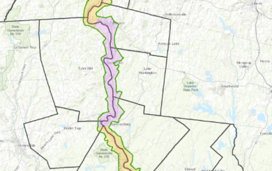
In 2016, Shippensburg University’s CLUS entered a five-year agreement with the National Park Service to develop and launch an effective and efficient spatial decisions support tool to assist with the review of projects within the 55,574.5-acre Upper Delaware Scenic and Recreational River Corridor that includes portions of five counties and 15 towns and townships in New York and Pennsylvania.
The Geographic Information Systems (GIS) mapping application integrates natural resource data with information on land use regulations and zoning as provided by the communities. It allows enabling numerous data layers and generating reports, and offers more accurate parcel descriptions than paper maps or some public online applications can provide.
The project resulted from a request by the UDC to the NPS for technical assistance to supplement the mapping included in the Final 1986 River Management Plan for the Upper Delaware Scenic and Recreational River using modern GIS technology.
Please contact UDC Resources and Land Use Specialist Shannon Cilento at (845) 252-3022 or shannon@upperdelawarecouncil.org with any questions.
